
STORY 83
Carry on through Gordon’s Bay on Clarence Drive. The road takes you along the R44, along the cliff road above False Bay, past the rocks and the swell and the fishermen sitting on the boulders with their lines in the water and into a stretch of coastline that most people in the Helderberg have never properly explored.
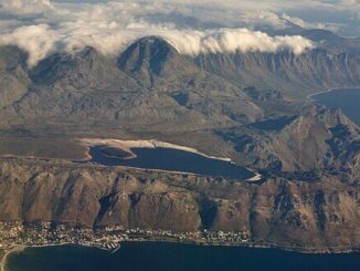
The coast between Gordon’s Bay and Hangklip the headland at the southeastern corner of False Bay is geologically and ecologically one of the most extraordinary stretches of shoreline in the Western Cape. It is also, by the standards of accessible coastline near a major metropolitan area, remarkably undeveloped. There are small towns. There are caravan parks. There are fishing spots that local families have used for three generations without publishing their locations. But there are no hotels on the beach, no casino resorts, no strip of restaurants facing the sea. The landscape has been stronger than the developers.
Pringle Bay is the first significant settlement past Gordon’s Bay on the Kogelberg coast. A small, scattered village of holiday homes and permanent residents, it sits behind a wide beach where the swell from False Bay comes in clean and long. It is the kind of place where people who discovered it twenty years ago feel a mild anxiety about too many people discovering it. The anxiety is understandable. It is also probably futile.
Rooi-Els Red Alder is one of the Western Cape’s most photographed coastal locations without most of the people photographing it knowing its name. The small village sits at the mouth of the Rooi-Els River, where the mountain drops almost directly into the sea and the road must negotiate a series of tight bends on the cliff face above the water. On a day when the south wind is up and the sea is running, the view from the Clarence Drive section of the R44 is one of the most dramatic in the country. On a calm winter morning, the bay below Rooi-Els is a mirror and the mountains behind it are snow-capped.
Clarence Drive itself the section of the R44 that hugs the cliff face between Gordon’s Bay and Rooi-Els has been on every South African road-trip list for decades. The road was carved into the cliff in the mid-twentieth century, blasted and graded from what had been a footpath and a fisherman’s track. In its time it was an engineering achievement. Now it is simply one of the most beautiful drives in the country, used daily by people commuting between the Kogelberg towns and Gordon’s Bay and driven slowly by visitors who pull over at the viewpoints and take pictures that do not quite capture what they are actually seeing.
Betty’s Bay is the largest settlement on the Kogelberg coast a sprawling holiday and retirement village that extends back from the beach into the fynbos. It is famous for two things: the Harold Porter National Botanical Garden, which preserves and displays the extraordinary fynbos flora of the Kogelberg Biosphere and the African penguin colony at Stony Point.
The Stony Point penguin colony is a remarkable thing. African penguins a species that breeds on offshore islands along the South African and Namibian coasts established a mainland breeding colony at Betty’s Bay that has grown over the decades into one of only two mainland colonies in the world. Visitors can walk a boardwalk through the colony, past birds that are entirely indifferent to human presence, within arm’s reach of nesting penguins, while the Kogelberg mountains rise behind them and the cold False Bay water turns green in the shallows below.
Hangklip the headland itself, the cape that confused so many navigators into thinking they had rounded the Cape of Good Hope is at the far eastern end of the Kogelberg coast. It is not easily accessible. The roads to it are rough and the private land around it is not welcoming to casual visitors. But its silhouette defines the eastern horizon of False Bay and it was important enough to navigators for three centuries that it earned its own name on every chart of the Cape.
The Helderberg ends where the Kogelberg coast begins. Or perhaps it is more accurate to say that they are the same thing the same mountain range, the same fynbos, the same sea, the same ancient geology separated only by the bend in the road at Gordon’s Bay.
Most Helderberg residents have driven Clarence Drive. Fewer have stopped. Fewer still have walked the Harold Porter gardens or sat at Stony Point at dusk while the penguins came in from the sea.
It is all right there. Around the corner.
Between You and Me:
Stony Point penguins at dusk. If you have not done this, do it. The boardwalk, the birds completely indifferent to your presence, the Kogelberg mountains going dark behind you and the sea turning that particular cold green-grey that False Bay does in the evening. Most Helderberg residents have driven Clarence Drive a hundred times on the way to somewhere else and never actually stopped at Betty’s Bay for this specific purpose. I understand why it is “around the corner,” and around the corner is exactly the kind of place you always mean to go and never quite do. But it is there, every evening, whether you go or not. The penguins do not mind either way. That is rather the point of them.
Historian – Harmen Bockelenberg
Next week: Wie se Gat the cave, the cattle thief and the name that has outlasted everyone who could explain it.


Be the first to comment