

Before Somerset West was a town, before the N2 was a road, before there were suburbs or schools or shopping centres in the valley between the Helderberg and the sea, the land was divided into farms. Not arbitrarily. Not randomly. The divisions followed the rivers, the ridges and the logic of the VOC’s expanding agricultural ambition and those divisions are still, to a remarkable degree, visible in the landscape today.
The system that created the Helderberg’s farms was the VOC loan farm. A settler, a vrijburger, a free citizen released from VOC service applied to the Company for permission to occupy a piece of land. The Company granted a loan place: not ownership, but use. The settler paid an annual recognition fee, farmed the land and gradually, over decades and generations, the loan became permanent and the farm became property. The boundaries were often defined by a half-hour’s ride from the farmhouse in every direction a measurement that sounds approximate but created farms of consistent and substantial size.
The rivers were the key. Farming in the Western Cape followed water and water followed rivers and the rivers of the Helderberg valley run from the mountains to the sea along axes that determined everything where the farms were, where the roads went, where the towns eventually grew. The Lourens River, running from the Helderberg slopes through the valley to False Bay, defined the Helderberg axis. The Eerste River, running westward to the sea near Faure, defined the Stellenbosch axis. Between them, the farms of the valley were laid out in the 1680s, 1690s and 1700s, grants that became estates that became the wine route that became the Helderberg as it exists today.
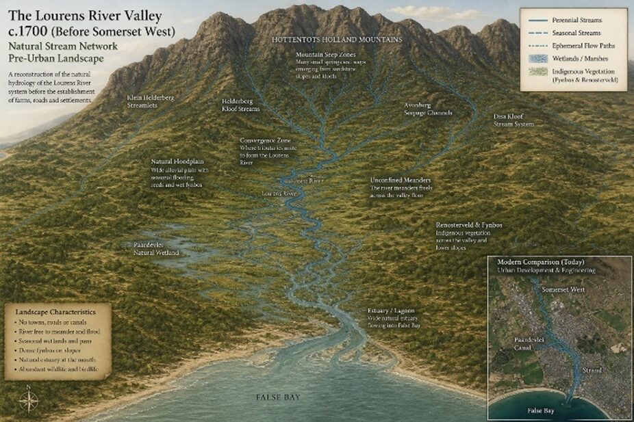
Vergelegen itself was granted to Willem Adriaan van der Stel in 1700, three days by ox-wagon from Cape Town and by the time he was recalled in disgrace six years later he had half a million vine stocks, eighteen cattle stations orchards and a homestead built with a scale and ambition the VOC never sanctioned. That farm, the one this book began with, the one Willem Adriaan van der Stel illegally occupied and transformed before being sent home in disgrace, set the template for everything that followed.
When van der Stel was recalled in 1707 and the vast Vergelegen estate was broken up on government orders, four farms emerged from its dissolution. Vergelegen itself, reduced to a more appropriate size. Lourensford, named for the river that ran through it. Morgenster, granted to a Huguenot settler and Cloetenburg, which would eventually become the site of Somerset House School. These four farms, all carved from the same original illegal land grab, are still recognisable on the modern map. The wine estates that bear those names today sit on essentially the same land, growing vines in the same soil, looking up at the same mountain that Willem Adriaan van der Stel looked at from his illegally constructed homestead three centuries ago.
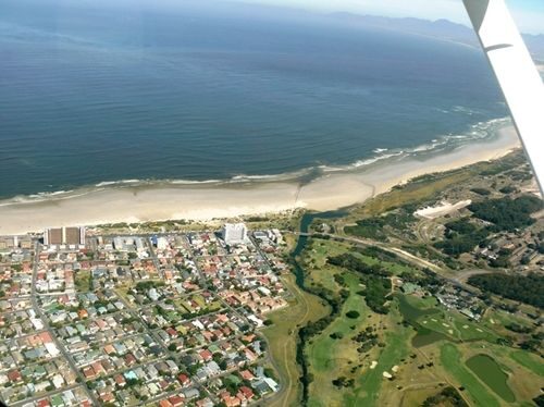
This is the remarkable thing about the Helderberg landscape: its bones are still the bones of the VOC era. The farm boundaries that were surveyed by VOC officials in the early eighteenth century are still, in broad outline, the boundaries of the estates that line the Lourens River today. The road that connects Somerset West to the wine farms follows the same valley that the first settlers rode through on horseback. The mountain that defines the skyline above every farm in the valley is the same mountain that every farmer in three hundred years of Helderberg history looked up at when the weather was turning.
The land remembers its original shape. You can see it if you know what you are looking at.
Between You and Me:
I find it genuinely remarkable that you can stand in the Lourens River valley today and still see, in broad outline, the same farm boundaries that VOC officials surveyed in the early 1700s. (Willem’s town.) The names on the gates are the same names. The roads follow the same valleys. The mountain looks the same. Three centuries of history happened in this valley and the bones of it are still the bones of the VOC era. It is like discovering that your house was built on a foundation laid in 1710 and the foundation is, against all probability, still perfectly level.
Historian – Harmen Bockelenberg
Next week: the names on the gates — who got the land, what they called it and why those names are still there three hundred years later.


Be the first to comment